

Radio stations in Norwich
Click on the radio station name to listen online. Local stations should give strong reception. The other stations, highlighted in light gray, will give weaker reception. Reception can vary within a town or city, in particular, more stations will be received on higher ground. Some community stations only cover part of a city. Many web-streams are limited to a UK audience only due to Broadcast licensing rules. |
| FM,MHz |
Station |
Transmitter |
| 89.7 |
 BBC Radio 2 BBC Radio 2
 |
Tacolneston |
| 91.9 |
 BBC Radio 3 BBC Radio 3
 |
Tacolneston |
| 94.1 |
 BBC Radio 4 BBC Radio 4
 |
Tacolneston |
| 95.1 |
 BBC Radio Norfolk BBC Radio Norfolk
 |
Stoke Holy Cross |
| 95.5 |
 BBC Radio Suffolk BBC Radio Suffolk
 |
Lowestoft, Oulton |
| 95.9 |
 BBC Radio Suffolk BBC Radio Suffolk
 |
Aldeburgh |
| 96.2 |
 Greatest Hits Radio (Norfolk) Greatest Hits Radio (Norfolk)
 |
Stody |
| 99.3 |
 BBC Radio 1 BBC Radio 1
 |
Tacolneston |
| 99.9 |
 Greatest Hits Radio (Norfolk) Greatest Hits Radio (Norfolk)
 |
Stoke Holy Cross |
| 101.5 |
 Classic FM Classic FM
 |
Tacolneston |
| 102.4 |
 Heart (Norfolk) Heart (Norfolk)
 |
Stoke Holy Cross |
| 103.4 |
 Greatest Hits Radio (Norfolk) Greatest Hits Radio (Norfolk)
 |
Lowestoft, Oulton |
| 104.4 |
 BBC Radio Norfolk BBC Radio Norfolk
 |
Great Massingham |
| 105.2 |
 Park Radio Park Radio
 |
Eye |
| 106.1 |
 Hits Radio (Norfolk) Hits Radio (Norfolk)
 |
Stoke Holy Cross |
| 106.4 |
 Greatest Hits (Ipswich) Greatest Hits (Ipswich)
 |
Ipswich, Mendlesham |
| 107.8 |
 Future Radio Future Radio
 |
Markham Tower |
|
| DAB,MHz |
Station |
Transmitter |
206.352
(9C)
 |
 Angel Vintage Angel Vintage

 Cambridge 105 Radio Cambridge 105 Radio

 Radio Caroline Radio Caroline

 Radio Caroline Flashback Radio Caroline Flashback

 Cosoro Afrobeats Cosoro Afrobeats

 Eruption Radio Eruption Radio

 Future Radio Future Radio

 GlitterBeam Radio GlitterBeam Radio

 Laser 558 Laser 558

 Radio Maria (England) Radio Maria (England)

 News Radio UK News Radio UK

 Resonance Extra Resonance Extra

 Select Radio Select Radio

 Skylab Radio Skylab Radio

 Slack City Radio Slack City Radio

 Solar Radio Solar Radio

 TMM 1 TMM 1

 TMM 2 TMM 2

 Zack FM Zack FM

 Weather 24/7 Radio Weather 24/7 Radio
 |
Markham Tower + Norfolk County Hall |
211.648
(10B)
 |
 BBC Radio Norfolk BBC Radio Norfolk

 Broadland Broadland

 Capital (UK) Capital (UK)

 Greatest Hits Radio (Norfolk) Greatest Hits Radio (Norfolk)

 Heart (Norfolk) Heart (Norfolk)

 Hits Radio (Norfolk) Hits Radio (Norfolk)

 Smooth Radio (Norfolk) Smooth Radio (Norfolk)

 Smooth Country Smooth Country
 |
Stok Holy Cross + Mousehold |
216.928
(11A)
 |
 Absolute Radio 80s Absolute Radio 80s

 Absolute Radio 90s Absolute Radio 90s

 Absolute Classic Rock Absolute Classic Rock

 Absolute Country Absolute Country

 BFBS Radio BFBS Radio

 Boom Radio Boom Radio

 Capital Anthems Capital Anthems

 Capital Xtra Reloaded Capital Xtra Reloaded

 Fix Radio Fix Radio

 Hits Radio Chilled Hits Radio Chilled

 Greatest Hits Radio 60s Greatest Hits Radio 60s

 Jazz FM Jazz FM

 Kerrang! Radio Kerrang! Radio

 KISSTORY R&B KISSTORY R&B

 Magic Classical Magic Classical

 Mellow Magic Mellow Magic

 Magic at the Musicals Magic at the Musicals

 Magic Soul Magic Soul

 Planet Rock Planet Rock

 Premier Christian Radio Premier Christian Radio

 Premier Praise Premier Praise

 Smooth 80s Smooth 80s

 Sunrise Radio (UK) Sunrise Radio (UK)

 Talk Talk

 talkSPORT 2 talkSPORT 2

 Times Radio Times Radio

 Virgin Radio Virgin Radio

 Virgin Radio Chilled Virgin Radio Chilled

 Virgin Radio Legends Virgin Radio Legends

 Radio X Classic Rock Radio X Classic Rock
 |
Stoke Holy Cross |
222.064
(11D)
 |
 Absolute Radio Absolute Radio

 Capital (UK) Capital (UK)

 Capital Dance Capital Dance

 Capital Xtra Capital Xtra

 Classic FM Classic FM

 GB News Radio GB News Radio

 Gold Radio Gold Radio

 Greatest Hits Radio 70s Greatest Hits Radio 70s

 Greatest Hits Radio 80s Greatest Hits Radio 80s

 Heart (UK) Heart (UK)

 Heart 70s Heart 70s

 Heart 80s Heart 80s

 Heart 90s Heart 90s

 Heart 00s Heart 00s

 Heart Dance Heart Dance

 Hits Radio 90s Hits Radio 90s

 Hits Radio 00s Hits Radio 00s

 KISS KISS

 KISSTORY KISSTORY

 LBC LBC

 LBC News LBC News

 Magic Radio Magic Radio

 Smooth Radio (UK) Smooth Radio (UK)

 Smooth Chill Smooth Chill

 Smooth Relax Smooth Relax

 Sunrise Hits Sunrise Hits

 talkSPORT talkSPORT

 UCB 1 UCB 1

 UCB 2 UCB 2

 Radio X Radio X
 |
Stoke Holy Cross |
225.648
(12B)
 |
 BBC Radio 1 BBC Radio 1

 BBC Radio 1 Anthems BBC Radio 1 Anthems

 BBC Radio 1 Dance BBC Radio 1 Dance

 BBC Radio 1Xtra BBC Radio 1Xtra

 BBC Radio 2 BBC Radio 2

 BBC Radio 3 BBC Radio 3

 BBC Radio 3 Unwind BBC Radio 3 Unwind

 BBC Radio 4 BBC Radio 4

 BBC Radio 4 Extra BBC Radio 4 Extra

 BBC Radio 5 Live BBC Radio 5 Live

 BBC Radio 5 Sports Extra BBC Radio 5 Sports Extra

 BBC Radio 6 Music BBC Radio 6 Music

 BBC Asian Network BBC Asian Network

 BBC World Service BBC World Service
 |
Stoke Holy Cross + Tacolneston |
|
| LW,kHz |
Station |
Transmitter |
| 198 |
 BBC Radio 4 BBC Radio 4
 |
Birmingham, Droitwich, 500 kW + Blackwall Tunnel + Rotherhithe Tunnel |
|
| MW,kHz |
Station |
Transmitter |
| 648 |
 Radio Caroline Radio Caroline
 |
Orfordness, 4 kW |
| 693 |
 BBC Radio 5 Live BBC Radio 5 Live
 |
Postwick, 15 kW |
| 855 |
 BBC Radio Norfolk BBC Radio Norfolk
 |
Postwick, 1 kW |
| 909 |
 BBC Radio 5 Live BBC Radio 5 Live
 |
London, Brookmans Park, 150 kW |
| 1089 |
 talkSPORT talkSPORT
 |
London, Brookmans Park, 400 kW |
| 1350 |
 Livewire Livewire
 |
Colney Training Centre, 1 W |
| |
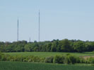
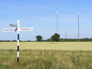
Tacolneston transmitting station
Coordinates:
52°31'07" N, 01°08'19" E 
; Elevation: 70 m; Tower height: 206.1 m
The Tacolneston transmitting station is a facility for both analogue and digital VHF/FM radio and UHF television transmission near Tacolneston, 11 miles south-west of Norwich, Norfolk, England.


More info:
Wikipedia

;
MB21

;
TheBigTower

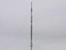
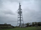
Stoke Holy Cross transmitting station
Coordinates:
52°34'29" N, 01°19'53" E 
; Elevation: 66 m; Tower height: 102 m
Stoke Holy Cross transmitting station is a broadcasting and telecommunications site located 4 miles south of Norwich.

More info:
Wikipedia

;
MB21


 BBC Radio 2
 BBC Radio 3
 BBC Radio 4
 BBC Radio Norfolk
 BBC Radio Suffolk
 Greatest Hits Radio (Norfolk)
 BBC Radio 1
 Classic FM
 Heart (Norfolk)
 Park Radio
 Hits Radio (Norfolk)
 Future Radio

 Angel Vintage
 Cambridge 105 Radio
 Radio Caroline
 Radio Caroline Flashback
 Cosoro Afrobeats
 Eruption Radio
 GlitterBeam Radio
 Laser 558
 Radio Maria (England)
 News Radio UK
 Resonance Extra
 Select Radio
 Skylab Radio
 Slack City Radio
 Solar Radio
 TMM 1
TMM 1
 Zack FM
 Weather 24/7 Radio

 Broadland
 Capital (UK)
 Smooth Radio (Norfolk)
 Smooth Country
 Absolute Radio 80s
 Absolute Radio 90s
 Absolute Classic Rock
 Absolute Country
 BFBS Radio
 Boom Radio
 Capital Anthems
 Capital Xtra Reloaded
 Fix Radio
 Hits Radio Chilled
 Greatest Hits Radio 60s
 Jazz FM
 Kerrang! Radio
 KISSTORY R&B
 Magic Classical
 Mellow Magic
 Magic at the Musicals
 Magic Soul
 Planet Rock
 Premier Christian Radio
 Premier Praise
 Smooth 80s
 Sunrise Radio (UK)
 Talk
Talk
 talkSPORT 2
 Times Radio
 Virgin Radio
 Virgin Radio Chilled
 Virgin Radio Legends
 Radio X Classic Rock
 Absolute Radio
 Capital Dance
 Capital Xtra
 GB News Radio
 Gold Radio
 Greatest Hits Radio 70s
 Greatest Hits Radio 80s
 Heart 70s
 Heart 80s
 Heart 90s
 Heart 00s
 Heart Dance
 Hits Radio 90s
 Hits Radio 00s
 KISS
KISS
 KISSTORY
 LBC
LBC
 LBC News
 Magic Radio
 Smooth Chill
 Smooth Relax
 Sunrise Hits
 talkSPORT
 UCB 1
UCB 1
 UCB 2
UCB 2
 Radio X

 BBC Radio 1 Anthems
 BBC Radio 1 Dance
 BBC Radio 1Xtra
 BBC Radio 3 Unwind
 BBC Radio 4 Extra
 BBC Radio 5 Live
 BBC Radio 5 Sports Extra
 BBC Radio 6 Music
 BBC Asian Network
 BBC World Service
 Livewire
